
Over 83 Eire signs were constructed around the coast in the summer of 1943 during WW2

CAMPAIGN TO RESTORE THE HOWTH “ÉIRE 6” SIGN
Only about twenty-three of these wartime EIRE signs are believed to have survived. Some have been, or are being, restored. One of these is the EIRE 7 sign at Dalkey, forming with Howth the two that marked out Dublin Bay. It was restored by Dalkey Tidy Towns volunteers.
In September 2019 a committed local group formed the Howth EIRE 6 Restoration Group. With strong community support, the group began working with Fingal County Council and the National Parks and Wildlife Service (NPWS) to restore the Howth Eire 6 sign.
On February 4th 2021 Ministerial permission from the NPWS was granted. The initial work to clear the letters began on Monday February 16th. All letters and the number 6 were clearly and easily identified. The restoration was complete in April 2022.
EIRE 6 Restoration Project: Key documents
Environmental Impact Statement
2. Ministerial Consent with NPWS conditions to proceed
3. Award of Heritage Council grant

LOCATION AND STRUCTURE OF THE HOWTH “EIRE 6” SIGN
The Look Out Post (LOP) of the Coast Watching Service in Howth, now demolished, had a field of vision south across Dublin Bay to other LOPs at Dalkey and Bray, and north to the next LOP at Clogher Head. Its coordinates were 53.371099,-6.054931. The “EIRE 6” sign, 0.7 km due northeast of the site of this LOP, on Howth’s East Mountain, when restored will be visible from the main flight path into Dublin. It is located at coordinates 53.3748125,- 6.0496875.
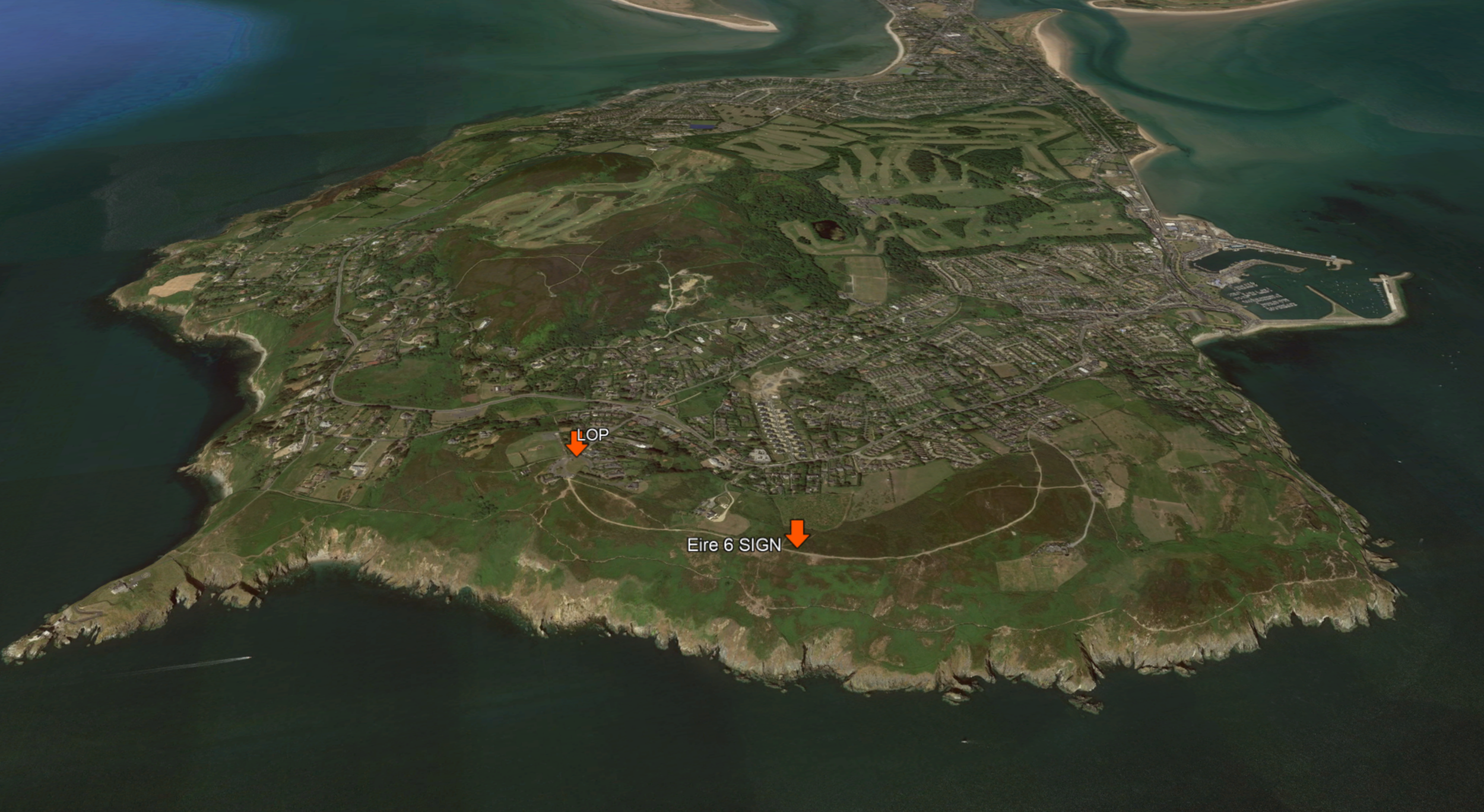
Location of the wartime “EIRE 6” sign and now demolished “Look Out Post” (LOP) on Howth

Allied aircraft were still prohibited from overflying neutral Irish territory, apart from the “Donegal Corridor”. But the numbered “EIRE” signs were soon marked on Allied navigational maps, assisting aircraft to accurately and safely navigate Ireland’s Atlantic and Irish Sea coasts without infringing Irish territory. The role the EIRE signs played assisting Allied aircrew navigate safely was later acknowledged by Allied forces, who thanked the Irish government for the assistance this had provided.

Originally
The “EIRE 6” sign was positioned within a triangular outer frame, formed by three paths, one, the east side, the present ‘Upper Cliff Path’ (at the bottom in the drawing below), another leading north-west, towards what is now a spruce plantation (at the apex of the triangle ) and a third, now buried on the northern side (at right in the drawing), which crossed an old track to a field of potato drills still visible in the landscape. This triangular framing of “EIRE 6” is unique, not seen elsewhere, encompassing an area of c. 2,670 m2 (0.27 Ha).
Note: The 2021 restoration will not include the triangle, as the restoration will be of the letters and numbers only.
See http://eiremarkings.org/ for more information on Eire signs around the Irish coast.